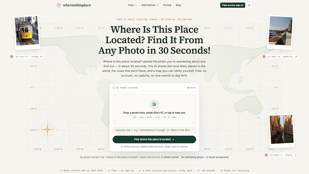
Where Is This Place Located? is a free AI-powered photo location finder that helps users identify the geographical origin of any image in approximately 30 seconds. Unlike traditional reverse image search tools like Google Lens, this service excels at locating places from photos that are not indexed online, including private pictures, old family photographs, and screenshots from social media platforms like Instagram or TikTok. It operates without relying on GPS or EXIF data, making it highly effective for images where such metadata has been stripped.
The tool employs a sophisticated 6-step pipeline to analyze photos. First, it performs an in-browser EXIF check to see if GPS coordinates are present; if so, it provides the exact location instantly. If not, the AI proceeds to a "Clue scan," where it meticulously reads visible elements within the frame. These visual clues fall into eight distinct categories:
- Signs & language: Identifying scripts, road signs, and text.
- Driving side & plates: Determining traffic direction and vehicle license plate characteristics.
- Architecture & roofs: Recognizing regional building styles and roof designs.
- Vegetation & terrain: Analyzing plant species, soil types, and geographical features.
- Road markings & bollards: Interpreting line colors, patterns, and street furniture.
- Utility poles & wires: Observing the design and arrangement of power infrastructure.
- Sun & shadows: Inferring hemisphere and latitude from light direction and shadow length.
- Storefronts & vehicles: Identifying local businesses, taxi colors, and car models.
Following the clue scan, an "Evidence double-check" verifies each cited clue against the image pixels, discarding any unsupported inferences to ensure accuracy and transparency. The system then presents "Ranked candidates," offering the top three most likely locations with calibrated confidence levels. Crucially, it honestly states "not enough evidence" when a photo lacks sufficient visual information, avoiding speculative guesses. Finally, a "Conclusion map" displays the source photo alongside an OSM/CARTO map, indicating the precision level (city, district, or street-level). For paid users, a "full evidence" report includes the complete clue list and a shareable link.
Key use cases include:
- Travelers: Identifying locations seen in screenshots or personal photos for future trips.
- Family Historians: Pinpointing the origins of old family prints.
- Journalists & OSINT Researchers: Verifying photo locations for factual reporting.
- Geography-Game Players: Learning geo-detection strategies by analyzing clues.
The service offers a free tier allowing up to 5 analyses per week (max 2 per day), providing candidate places, confidence, reasoning, and a map without requiring an account or captcha. Paid options (Plus subscription or single unlocks) provide full evidence reports. The platform boasts a transparent accuracy benchmark, reporting 95% correct country and 87% correct city on a public 50-photo test set. Privacy is paramount: photos are auto-deleted within 24 hours, never used for AI training, and GPS data is processed locally in the browser. The tool is designed to identify places, not people, and explicitly blocks attempts to track individuals.